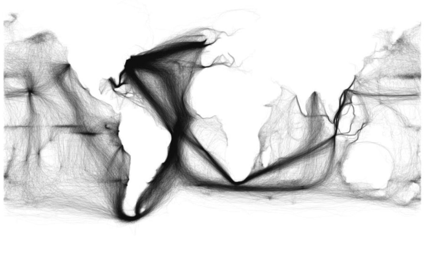
Because we have solid information on the movement of ships, scholars have been developing innovative representations on topics such as commercial shipping and whaling. This information—which often includes meteorological data and other observations—is now being used to help reconstruct climate and oceanic systems. This map, depicting shipping, helps us understand the importance of the Atlantic world in the century that saw the rise of the British Empire.
 Skip to content