 Skip to content
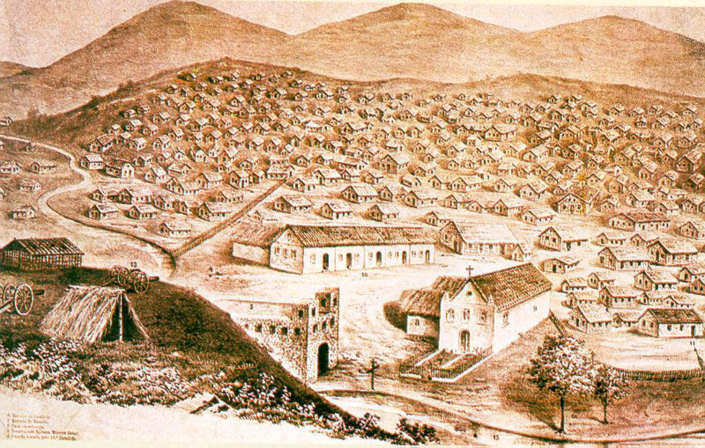
Ch11.3. Ingenio Acana
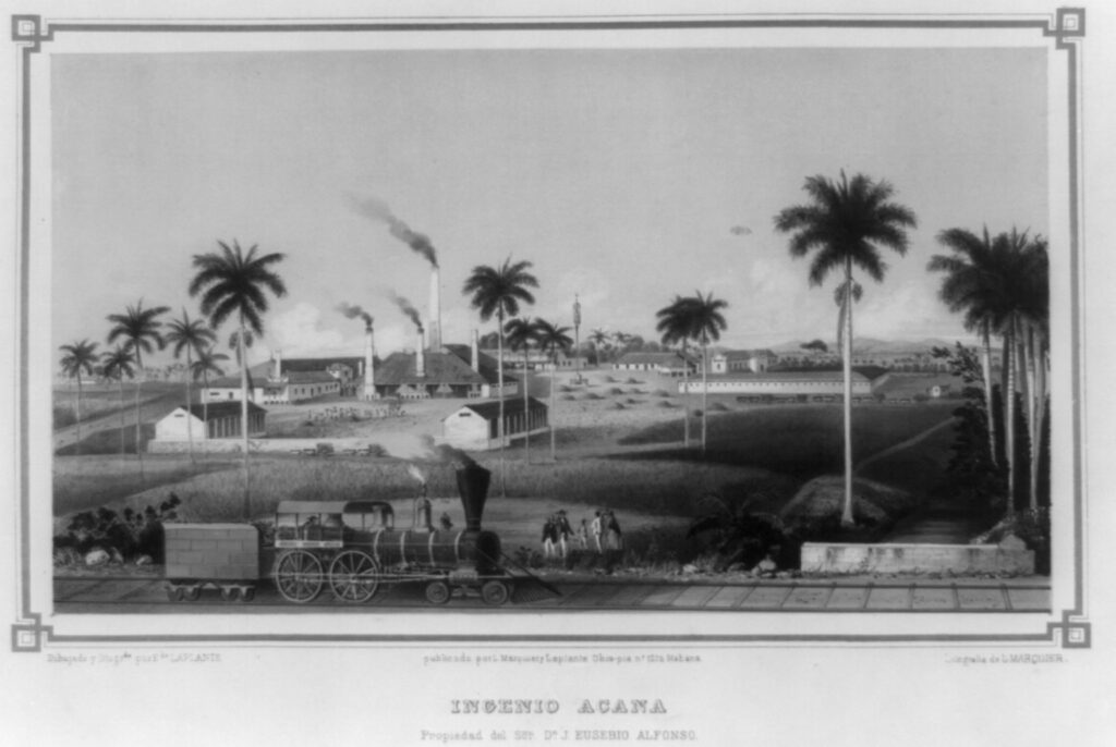
back to images & maps Ingenio Acana The Cuban sugar revolution was unparalleled anywhere in the world. Here one can clearly see the combination of steam technology to the production of sugar, the train in the foreground and the smokestacks in the background. Decidedly absent in this illustration are the enslaved people that made sugar […]
Ch. 5.2 The Nile slave district
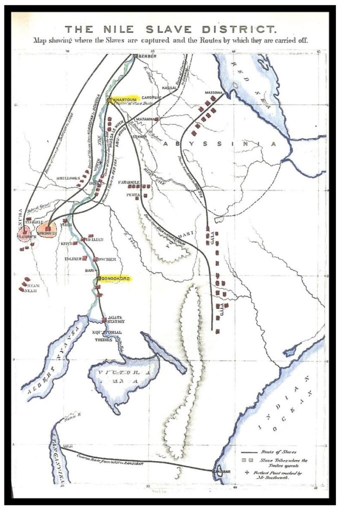
back to images & maps The Nile slave district The great bulk of historical scholarship on slavery has focused on the transport of millions of enslaved people across the Atlantic Ocean. But there were other slave trades, including one moving from East Africa and the Sudan to Egypt. These routes are ancient, but they dramatically […]
Ch4.3. Duke Town
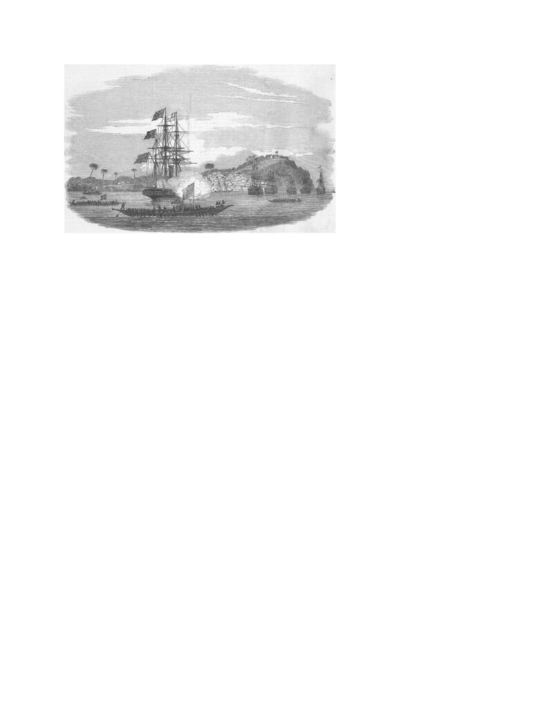
back to images & maps Duke Town, with Old Calabar, 1850. This image comes not from the era of the Atlantic slave trade, which the British had abolished in the early part of the nineteenth century, but from the beginning of the age of European imperialism. Note the variety of African and European vessels. In […]
Ch 1.3. Early Industrial Birmingham
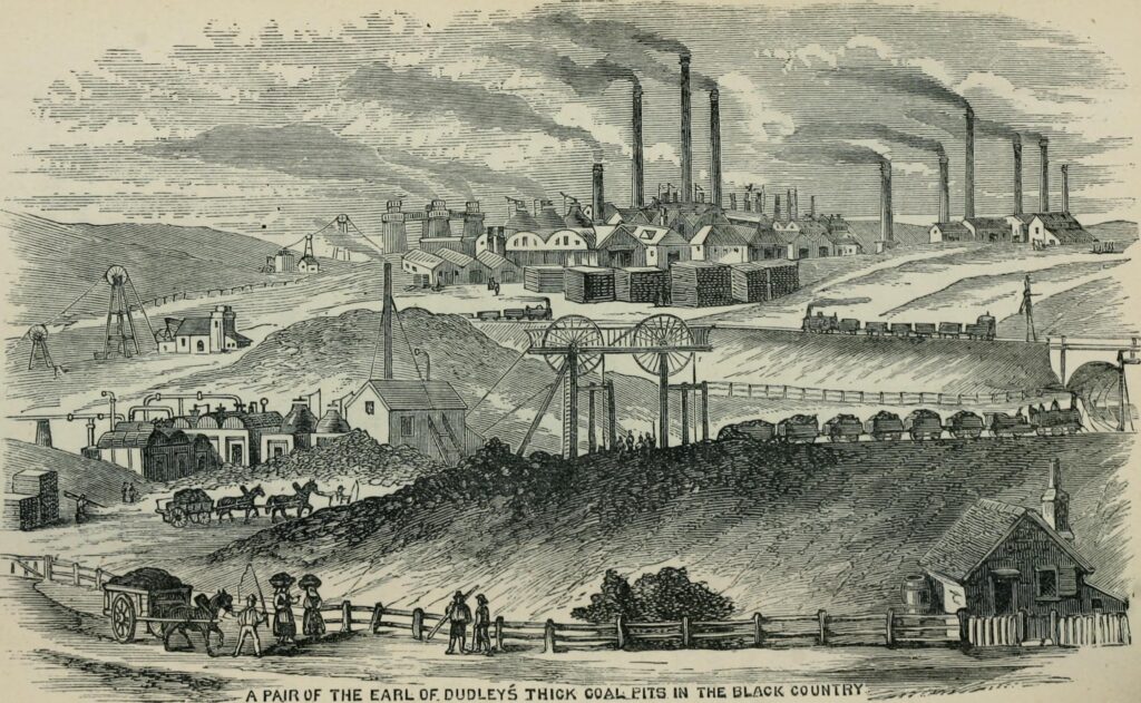
back to images & maps Early Industrial Birmingham We usually think of Manchester as the birthplace of England’s industrial revolution. The truth is more complicated. For example, there was widespread use of steam engines in London and in other emerging cities, especially Birmingham. Birmingham was well positioned, with nearby coal and metal deposits. This illustration […]
Ch 1.1 Entry and Exit Wound
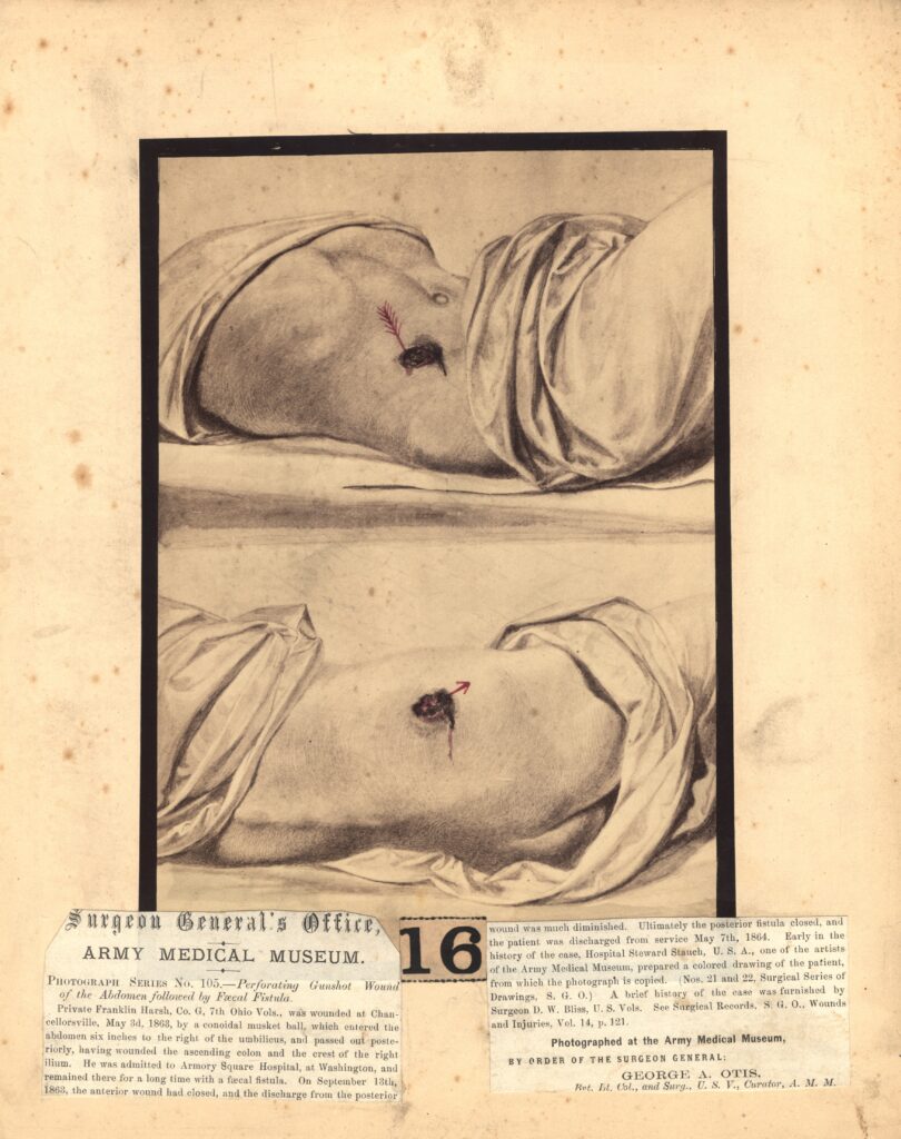
back to images & maps Ch1.1. Entry and Exit Wound. Ch1.1. Entry and Exit Wound. The musket changed warfare, everything from tactics to the experience of pain. It also changed medicine. The gun produced gaping wounds and shattered bones, very different from weapons like an arrow. This image, from the Surgeon General’s Office, comes from […]
Ch19.1. “The Battle of Greasy Grass”
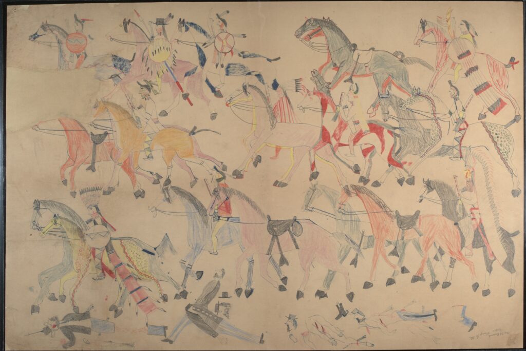
back to images & maps Ch19.1. “The Battle of Greasy Grass Ch19.1. “The Battle of Greasy Grass,” Red Horse, 1881. Smithsonian Institution. Otherwise known as the “Battle of Little Bighorn” or “Custer’s Last Stand,” this drawing offers an indigenous perspective on one of the most significant moments in the War of 1876 between the Lakota […]
Ch18.4. Putumayo Slaves
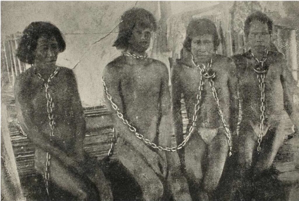
back to images & maps Ch18.4. Putumayo Slaves Ch18.4. Putumayo Slaves. One of the most famous images from the exposé of the enslavement and destruction of indigenous communities across the Amazon during the mad rush for rubber, then rapidly becoming one of the world’s most important commodities. Roger Casement and others helped bring attention to […]
Ch18.3. Rubber boom
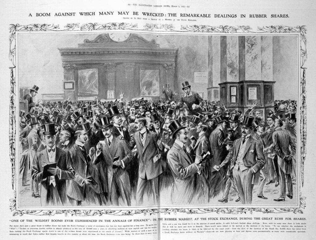
back to images & maps Ch18.3 Rubber boom Ch18.3. Rubber boom, The Illustrated London News, 1910. British Library. Without rubber, the modern world as we know it would not exist, from car tires to gaskets, and much else. Today, the world consumes more than 66 billion tons of natural and synthetic rubber yearly, the equivalent […]
Ch18.2. Canudos
back to images & maps Ch18.2. Canudos Canudos. The “beautiful hill.” This is how many of those who settled in Canudos imagined their community. Across the nineteenth-century world, utopian communities and millenarian movements emerged that explicitly critiqued—and sometimes condemned—capitalism and colonialism and imagined different futures. They could be found on every continent, including the Americas, […]
Ch.18.1. The Yucatan Caste War
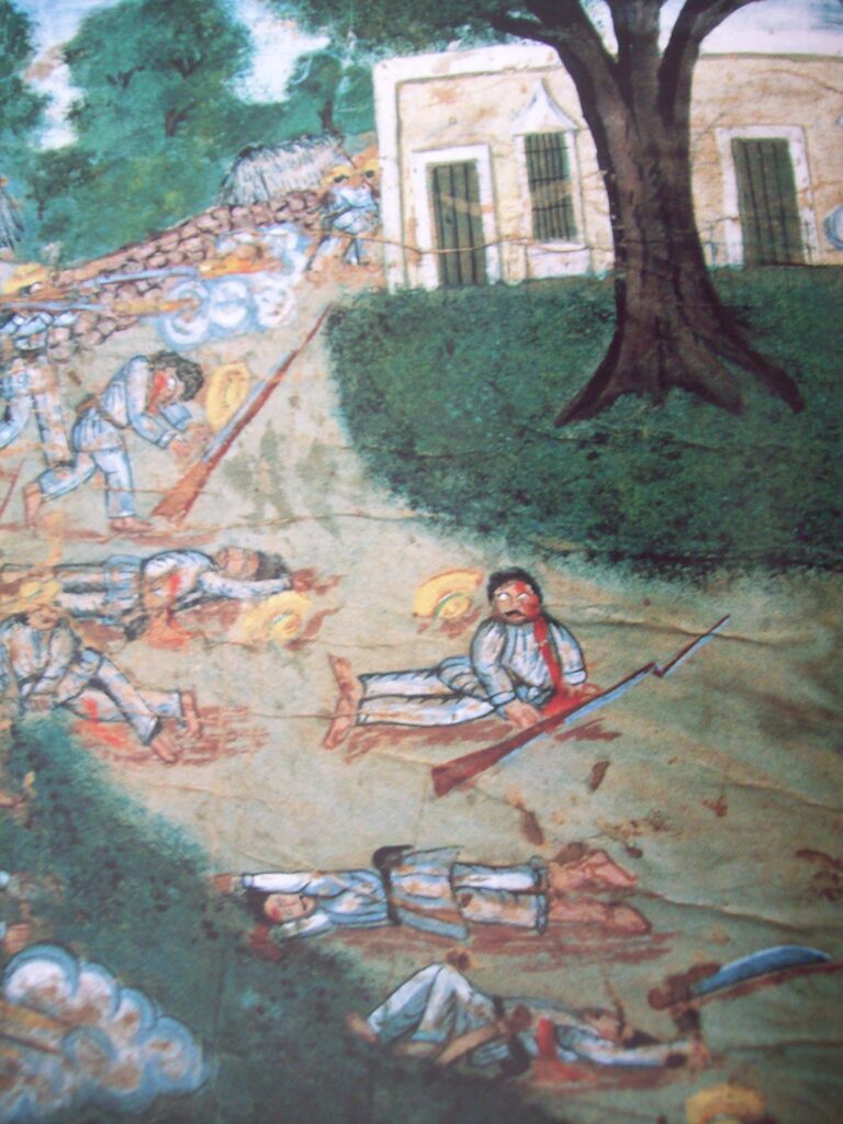
back to images & maps Ch.18.1. The Yucatan Caste War The Yucatan Caste War. The great Caste War was widely reported in the Western media. It also produced poetry, songs, and art. This painting illustrates one of the battles during the long war that decimated communities across Yucatan. We are still learning more about this […]