 Skip to content
Map 19.1 Conflicts across North America in the nineteenth century
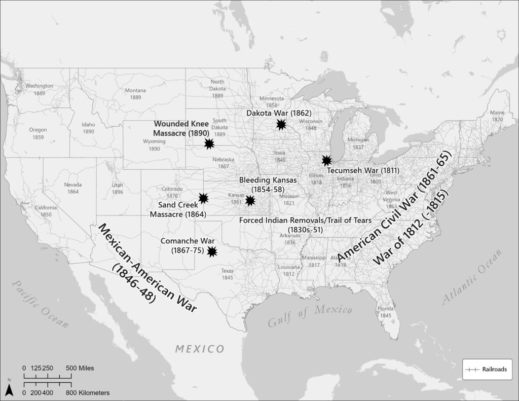
back to images & maps This map depicts two processes, each interrelated. The first identifies just a very few—there were literally many hundreds—of the major conflicts unfolding across the United States in the 1800s. The second process is the redrawing of the continent’s political geography, particularly the creation of states within the American federal system. […]
Map 18.1 Latin America in the nineteenth century
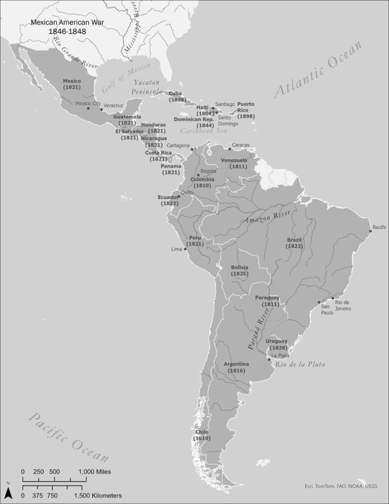
back to images & maps Compare this map to Map 7.1. A profound political transformation had unfolded from Canada to Chile. The Spanish and Portuguese empires had come to an end, and the new United States empire was spreading rapidly west of the Mississippi River.
Map 17.1. Asia in the age of empire
back to images & maps The Qing and Russian empires were the nineteenth century’s largest land-based empires, followed by the United States. This map depicts the extent of the Qing Empire at its greatest extent, and some of the cataclysms that unfolded on its eastern flank in the nineteenth century as Western imperialism insinuated itself […]
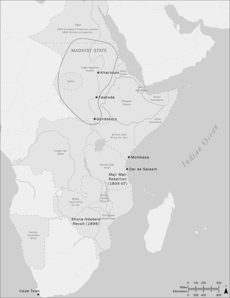
Map 15.1 Northern and Eastern Africa in the age of empire
back to images & maps This map should be brought alongside map 14.1. Together, they help us understand the political transformation of Africa in the nineteenth century. Of special importance is the role of chartered companies. In many areas, these were the shock troops of colonial conquest, to be followed later by formal European rule.
Map 14.1. West Africa in the age of empire
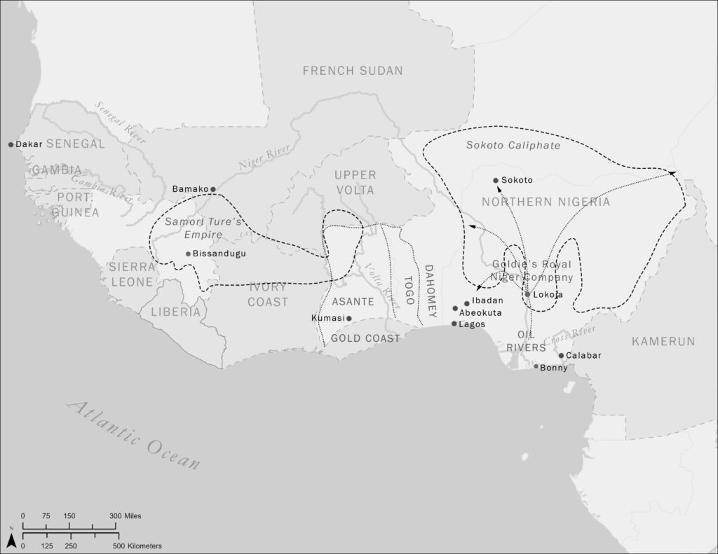
back to images & maps Scholars usually write of the “Scramble for Africa.” In fact, there were many scrambles, and not just a European one. Africans were also rewriting the map of Africa, for example the Sokoto Caliphate and the empire of Samori Ture. We can only understand the continent’s modern history by bringing together […]
Map 7.2. North America
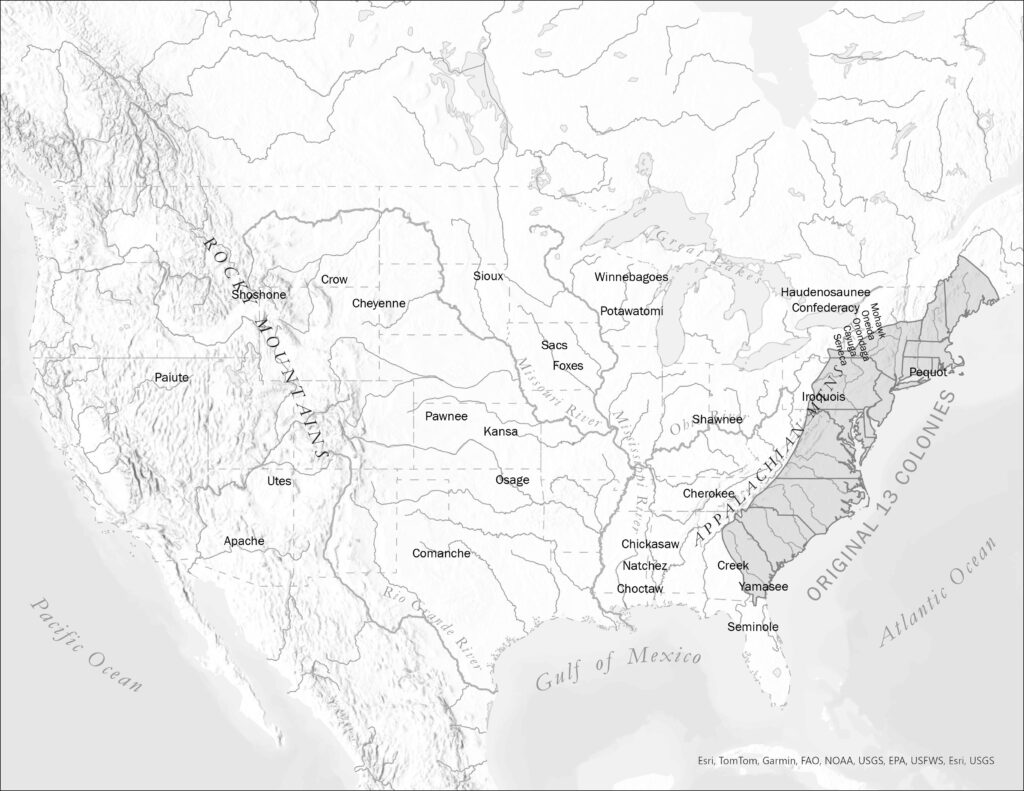
back to images & maps Here is a map focusing mostly on the area that would become the United States of America. From the original thirteen colonies hugging the Atlantic Ocean would emerge a vast settler society and empire, one of the most dramatic—and violent—developments in world history, involving both the destruction of the environment […]
Map 7.1. Latin America in the eighteenth century
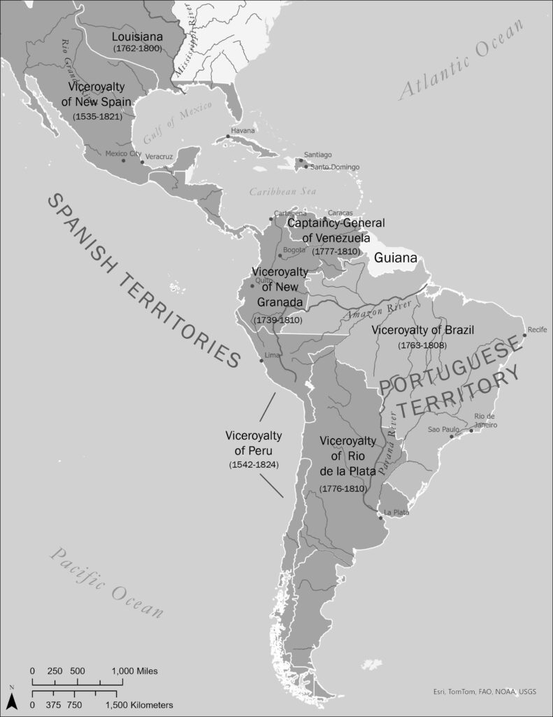
back to images & maps North Americans and especially many citizens of the United States forget that well into the nineteenth century most of the Americas were part of the Spanish and Portugues empires. The British Empire held relatively small regions, in the United States east of the Mississippi River and considerable parts of the […]
Map 6.1. Indian Ocean world
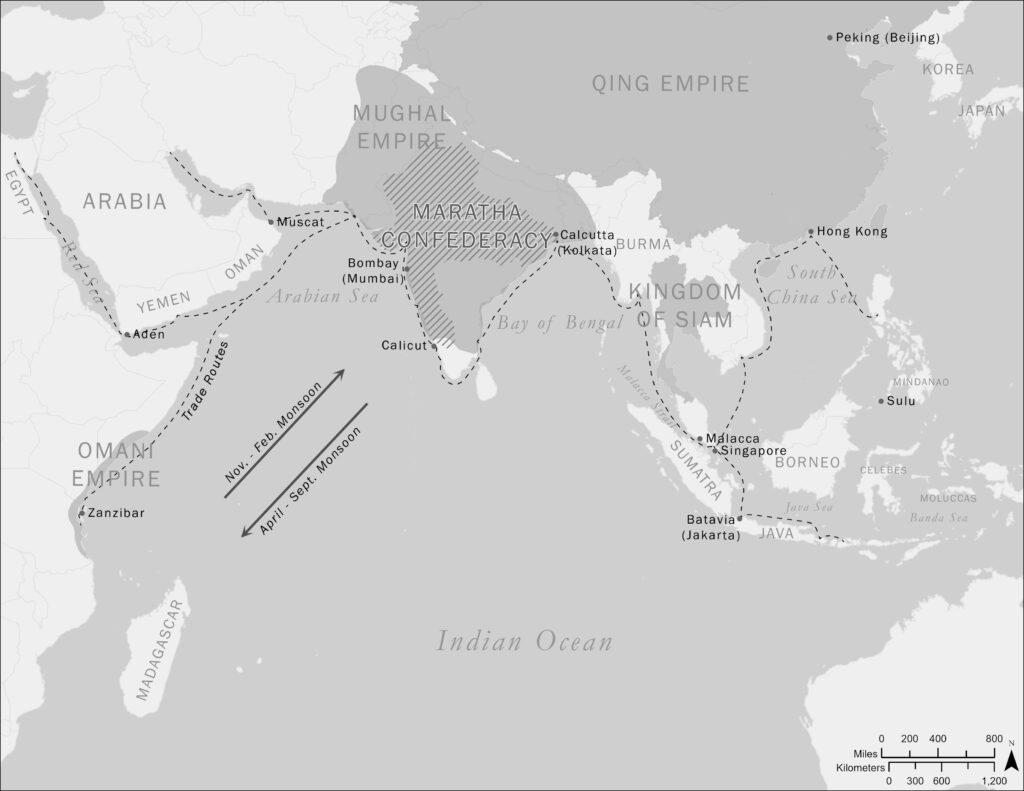
back to images & maps Place Map 5.1 alongside this map of the Indian Ocean world, add Map 2.1 on British shipping, and you will get a sense of the bewildering complexity and diversity of this part of the planet. What is not represented here is the traffic of dhows moving along monsoonal systems in […]
Map 5.1. East Africa in the nineteenth century
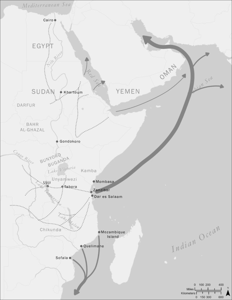
back to images & maps This map illustrates the overland and overseas routes taken by enslaved peoples in nineteenth century East Africa. Our understanding of enslavement in this region is not nearly as detailed as it is for the Atlantic world. However, we know that enslavement expanded dramatically in this period, utterly transforming vast areas […]
Map 4.1. West Africa and West-Central Africa
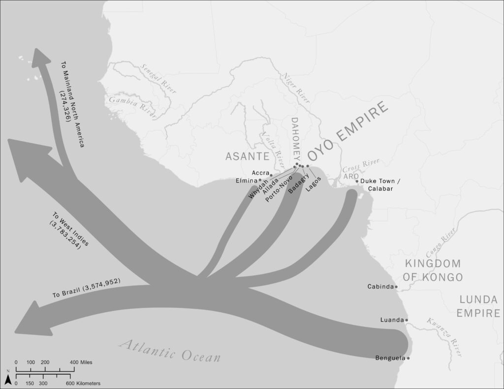
back to images & maps The Atlantic Slave Trade went on for over 350 years. It grew to monstrous proportions in the eighteenth and into the nineteenth centuries. Most enslaved people went to Brazil and the West Indies, as this map demonstrates. As research continues, we are developing an ever more detailed understanding of the […]