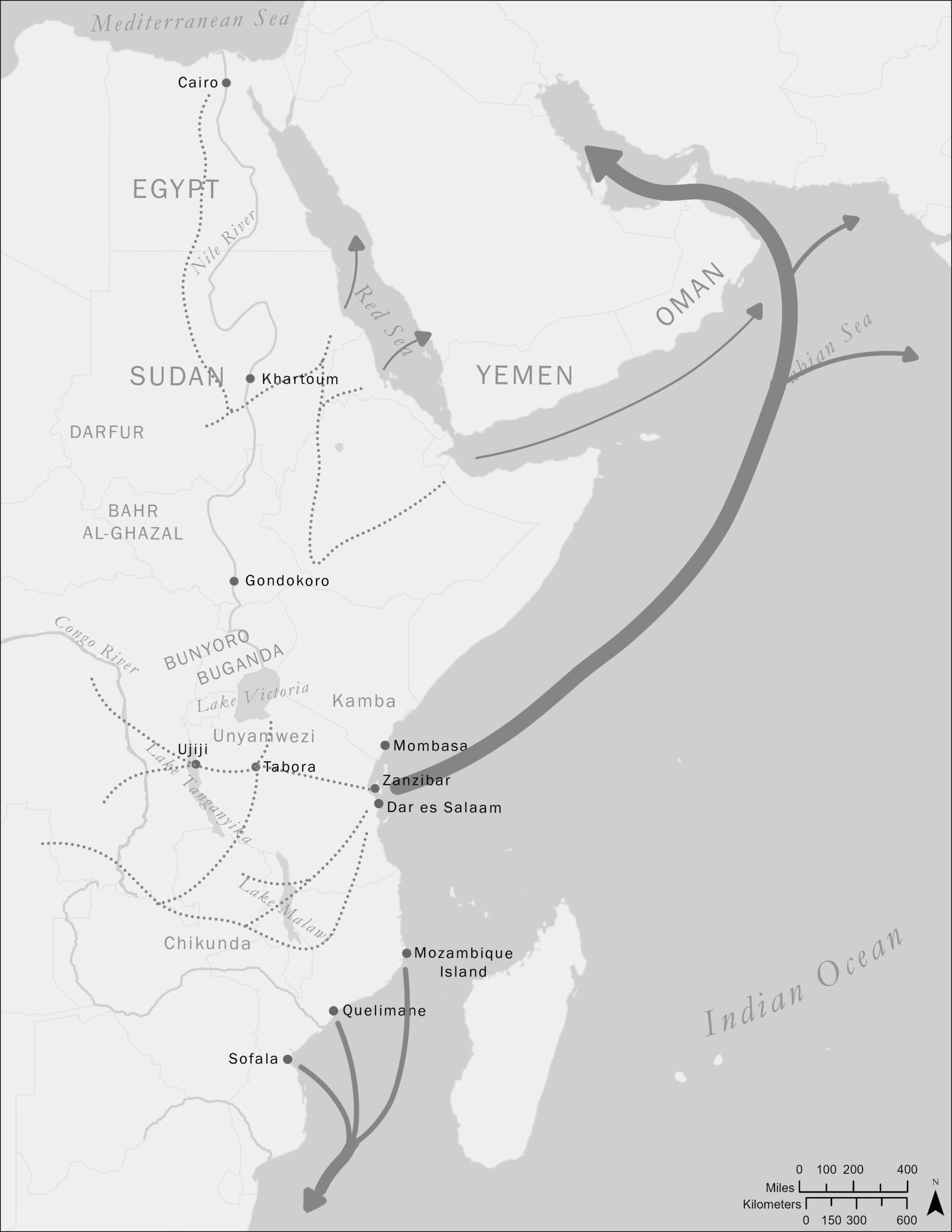
This map illustrates the overland and overseas routes taken by enslaved peoples in nineteenth century East Africa. Our understanding of enslavement in this region is not nearly as detailed as it is for the Atlantic world. However, we know that enslavement expanded dramatically in this period, utterly transforming vast areas of the world. African slaves from East Africa ended up on the coast, North Africa, the Arabian Peninsula, India and Indonesia, and in Brazil and Cuba, the most diverse trade in human beings in modern history.
 Skip to content