 Skip to content
Map 18.1 Latin America in the nineteenth century
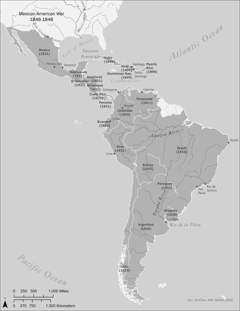
back to images & maps Compare this map to Map 7.1. A profound political transformation had unfolded from Canada to Chile. The Spanish and Portuguese empires had come to an end, and the new United States empire was spreading rapidly west of the Mississippi River.
Ch18.4. Putumayo Slaves
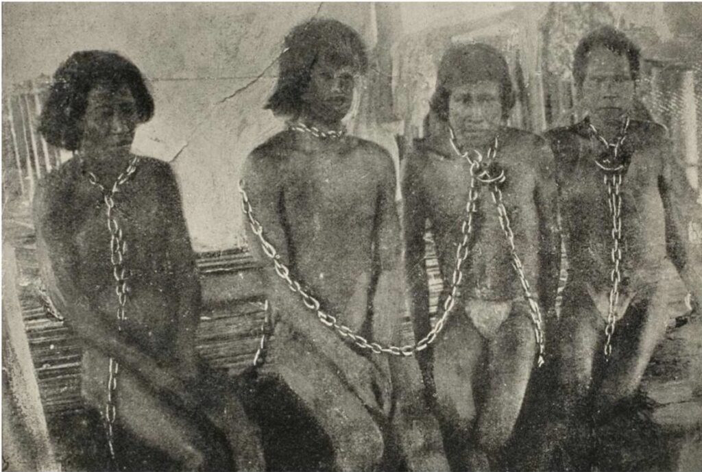
back to images & maps Ch18.4. Putumayo Slaves Ch18.4. Putumayo Slaves. One of the most famous images from the exposé of the enslavement and destruction of indigenous communities across the Amazon during the mad rush for rubber, then rapidly becoming one of the world’s most important commodities. Roger Casement and others helped bring attention to […]
Ch18.3. Rubber boom
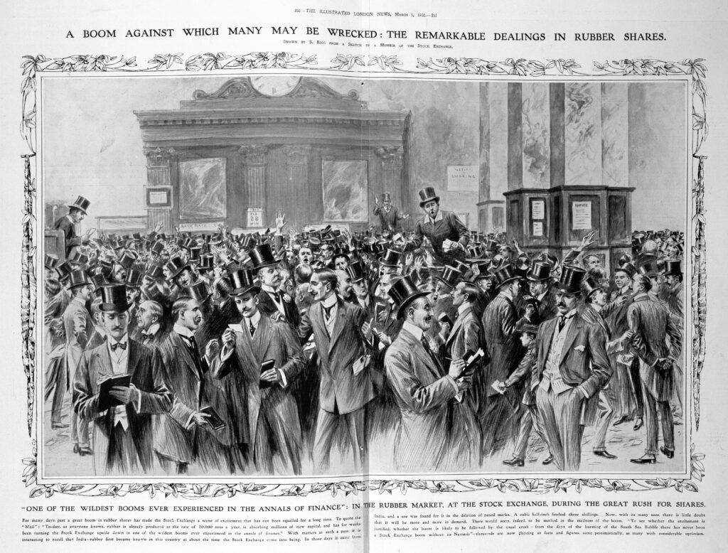
back to images & maps Ch18.3 Rubber boom Ch18.3. Rubber boom, The Illustrated London News, 1910. British Library. Without rubber, the modern world as we know it would not exist, from car tires to gaskets, and much else. Today, the world consumes more than 66 billion tons of natural and synthetic rubber yearly, the equivalent […]
Ch18.2. Canudos
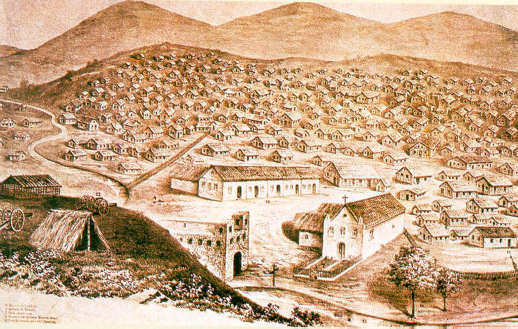
back to images & maps Ch18.2. Canudos Canudos. The “beautiful hill.” This is how many of those who settled in Canudos imagined their community. Across the nineteenth-century world, utopian communities and millenarian movements emerged that explicitly critiqued—and sometimes condemned—capitalism and colonialism and imagined different futures. They could be found on every continent, including the Americas, […]
Ch.18.1. The Yucatan Caste War
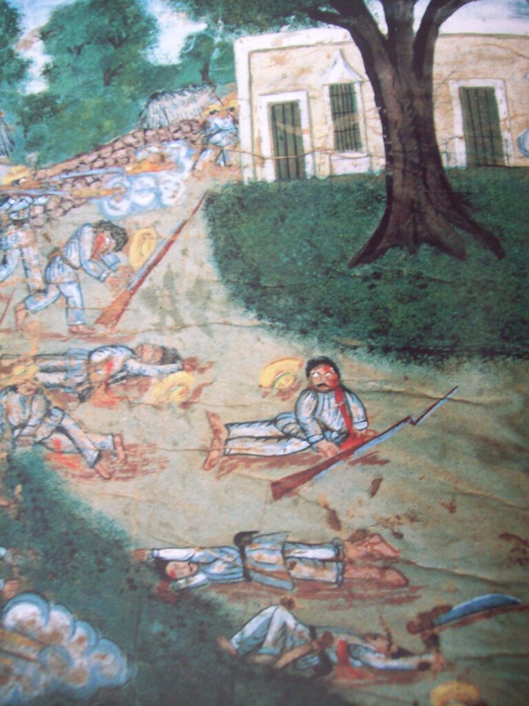
back to images & maps Ch.18.1. The Yucatan Caste War The Yucatan Caste War. The great Caste War was widely reported in the Western media. It also produced poetry, songs, and art. This painting illustrates one of the battles during the long war that decimated communities across Yucatan. We are still learning more about this […]