 Skip to content
Map 15.1 Northern and Eastern Africa in the age of empire
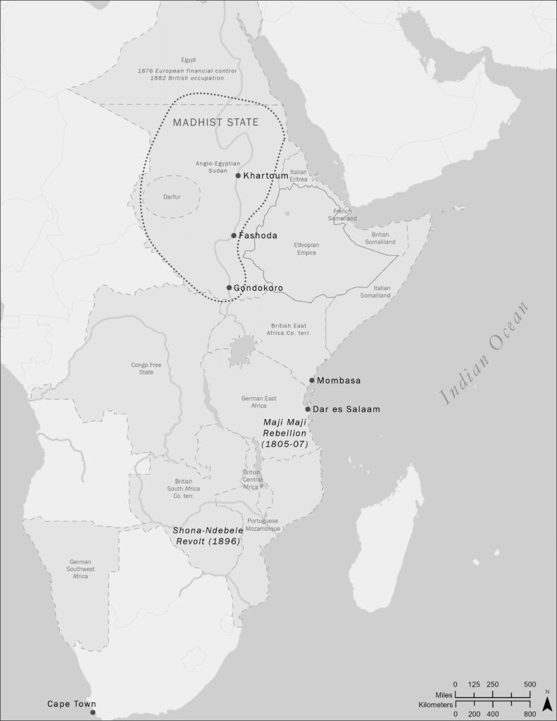
back to images & maps This map should be brought alongside map 14.1. Together, they help us understand the political transformation of Africa in the nineteenth century. Of special importance is the role of chartered companies. In many areas, these were the shock troops of colonial conquest, to be followed later by formal European rule.
Ch15.3. The spirit mediums Nehanda and Kabugi
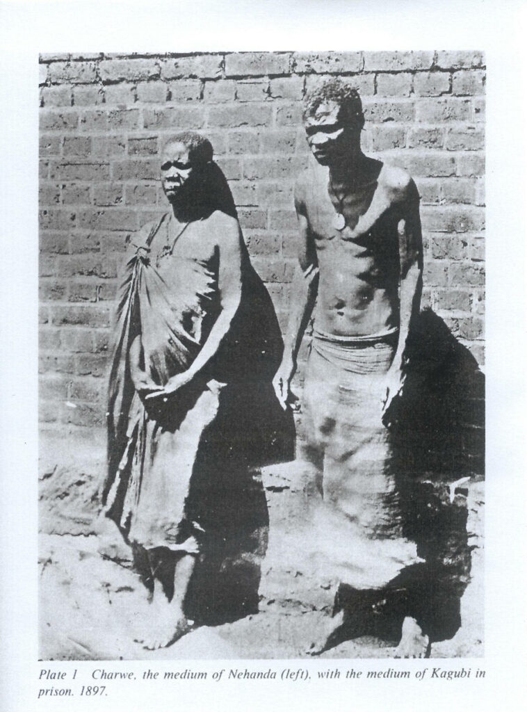
back to images & maps Ch15.3. The spirit mediums Nehanda and Kabugi The spirit mediums Nehanda and Kabugi, Southern Rhodesia, 1897. Spirit mediums once played a vital role in Shona society. Royal ancestors (mhondoro) living in animals such as lions would travel and possess individuals, just as other ancestors also possessed the living. Mhondoro spirits, […]
Ch15.2. Treaty form, Imperial British East Africa Company
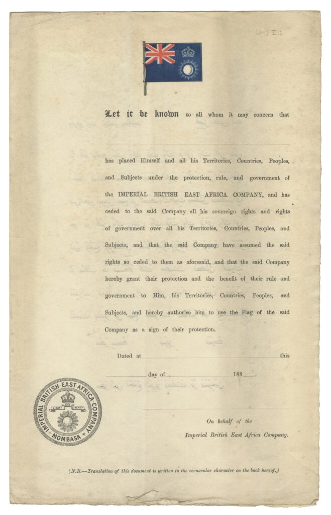
back to images & maps Ch15.2. Treaty form, Imperial British East Africa Company Treaty form, Imperial British East Africa Company, 1880s. Royal Geographical Society. Imagine Frederick Lugard invading East Africa’s interior with a bunch of forms in his satchel, cajoling and forcing African leaders to cede their sovereignty to the company. This is how nineteenth […]
Ch15.1. “Ruins on one side of Grand Square Alexandria”
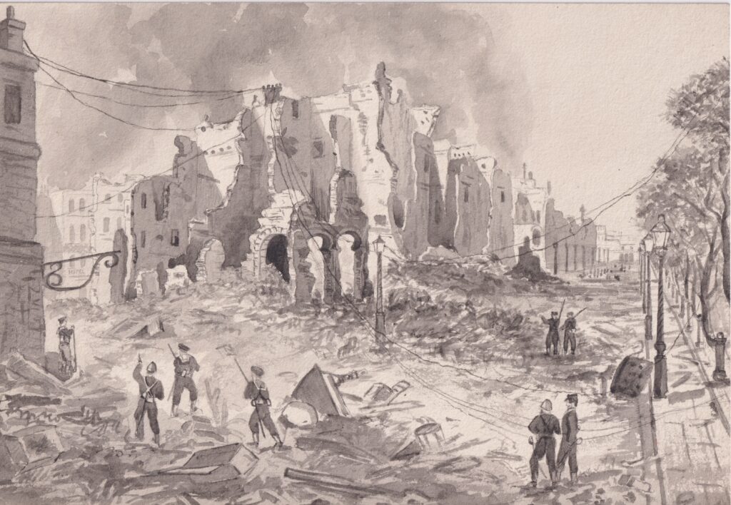
back to images & maps Ch15.1. “Ruins on one side of Grand Square Alexandria” “Ruins on one side of Grand Square Alexandria,” 1882, by Lieutenant Francis Henry Boyer. National Royal Navy Museum. The British bombardment and invasion of Alexandria was one of the most cataclysmic events in modern Egyptian history, and the culmination of developments […]